Sujet
'Map illustrating the Operations of the First Army...', First World War, 1915, (c1920). Creator: Unknown.
Légende
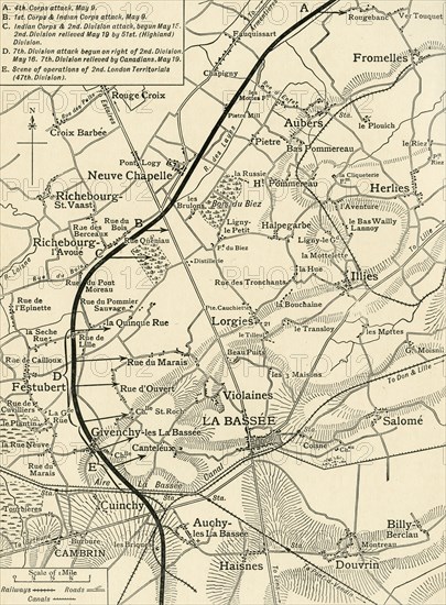
'Map illustrating the Operations of the First Army, under Sir Douglas Haig, during May and June, 1915', First World War, (c1920). Part of northern France showing British positions near the town of Neuve-Chapelle. From "The Great World War - A History" Volume III, edited by Frank A Mumby. [The Gresham Publishing Company Ltd, London, c1920]
Date
1915
Crédit
Photo12/Heritage Images/The Print Collector
Notre référence
HRM19F26_048
Model release
NA
Property release
NA
Licence
Droits gérés
Format disponible
59,3Mo (4,1Mo) / 33,1cm x 44,9cm / 3907 x 5304 (300dpi)