Sujet
'Map to illustrate the Battle of Messines', First World War, June 1917, (c1920). Creator: Unknown.
Légende
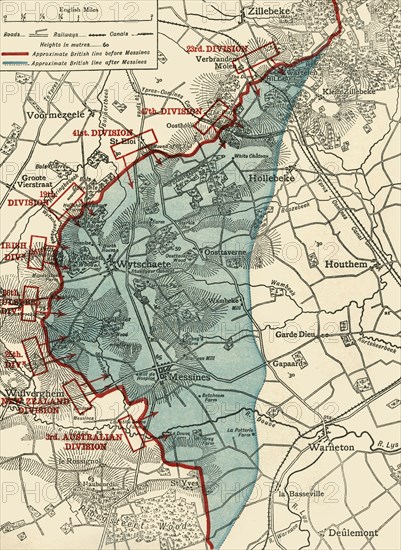
'Map to illustrate the Battle of Messines', First World War, June 1917, (c1920). The blue area shows ground gained from the Germans by the British under General Sir Herbert Plumer, 7-14 June 1917. The battle took place on the Western Front near the village of Messines in West Flanders, Belgium. From "The Great World War: A History", Volume VII, edited by Frank A Mumby. [The Gresham Publishing Company Ltd, London, c1920]
Date
1917
Crédit
Photo12/Heritage Images/The Print Collector
Notre référence
HRM19F27_427
Model release
NA
Property release
NA
Licence
Droits gérés
Format disponible
62,1Mo (6,9Mo) / 33,7cm x 46,2cm / 3981 x 5456 (300dpi)