Sujet
'Map illustrating the First Battles of Cambrai, November-December 1917', (c1920). Creator: Unknown.
Légende
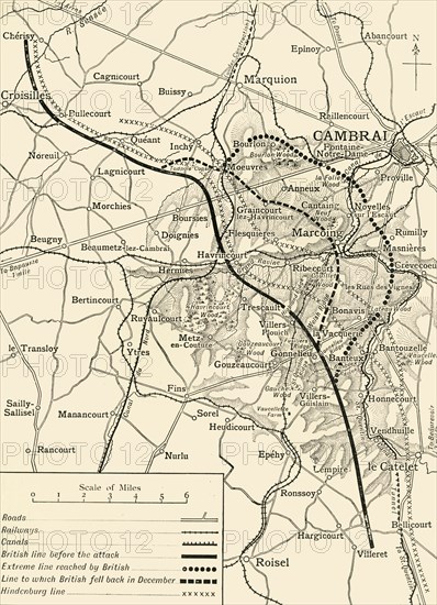
'Map illustrating the First Battles of Cambrai, November-December 1917', (c1920). 'Note - Hill shading is shown only in the area covered by the sphere of operations described'. The Battle of Cambrai during the First World War was fought around the town of Cambrai in northern France. Also indicated are: 'British line before attack', 'Extreme line reached by British', 'Line to which British fell back in December', and the 'Hindenburg line'. From "The Great World War: A History", Volume VII, edited by Frank A Mumby. [The Gresham Publishing Company Ltd, London, c1920]
Date
1917
Crédit
Photo12/Heritage Images/The Print Collector
Notre référence
HRM19F27_442
Model release
NA
Property release
NA
Licence
Droits gérés
Format disponible
61,3Mo (4,7Mo) / 33,4cm x 46,0cm / 3942 x 5436 (300dpi)