Sujet
'Map illustrating the Closing Phases of the East African Campaign, 1917-18', (c1920). Creator: Unknown.
Légende
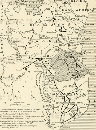
'Map illustrating the Closing Phases of the East African Campaign, 1917-18', (c1920). European powers in Africa during the First World War: 'Shaded area showing Territory still held by the enemy in German East Africa at the beginning of 1917; Coastal areas held by British troops; General von Lettow-Vorbeck's track from December 1916 to his surrender on November 14, 1918; Colonel Tafel's line of retreat from the Mohenge district until his surrender on November 27, 1918; Track of the Wintgens-Naumann raiding force, February-October 1917'. From "The Great World War: A History", Volume IX, edited by Frank A Mumby. [The Gresham Publishing Company Ltd, London, c1920]
Date
1917
Crédit
Photo12/Heritage Images/The Print Collector
Notre référence
HRM19F27_460
Model release
NA
Property release
NA
Licence
Droits gérés
Format disponible
59,9Mo (5,3Mo) / 33,3cm x 45,1cm / 3937 x 5321 (300dpi)