Sujet
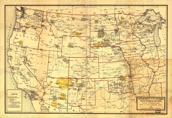
Indian Reservations west of the Mississippi River, 1923. Creator: Office of Indian Affairs.
Légende
Indian Reservations west of the Mississippi River, 1923. This map, created by the Office of Indian Affairs in 1923, shows the location of Indian reservations west of the Mississippi River. The names of the tribes are given and important geographic features such as state boundaries and rivers and railways are shown. Reservation schools and hospitals are also marked. In 1924, Congress passed the Indian Citizenship Act, which granted citizenship rights to Native Americans.
Crédit
Photo12/Heritage Images/Heritage Art
Notre référence
HRM24A00_098
Model release
NA
Property release
NA
Licence
Droits gérés
Format disponible
300,2Mo (16,7Mo) / 104,4cm x 72,1cm / 12326 x 8512 (300dpi)