Title
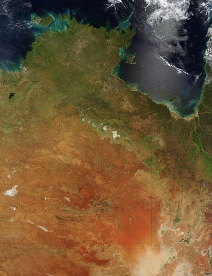
satellite view over Northern Australia
Caption
satellite view over Northern Australia, shows the northern portion of the Northern Territory, sometimes known as the Top End. There are also a few large islands visible, including Melville and Bathurst Islands to the north and the smaller Groote Eylandt to the east. The Timor Sea is to the west, with the Arafura Sea to the north, and the Gulf of Carpentaria to the east.
Credit line
Photo12/Ann Ronan Picture Library
Reference
ARP11A00_064
License type
Rights managed
Available size
50,9Mb (3,8Mb) / 12,3in x 16,0in / 3700 x 4810 (300dpi)