Title
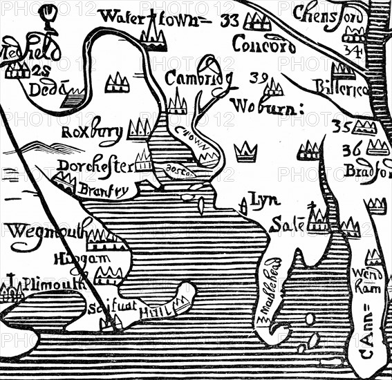
Early map of Massachusetts Bay, America
Caption
Early map of Massachusetts Bay, America. Massachusetts was first settled by the Pilgrim Fathers, the Puritans who escaped religious persecution in England and sailed to America from Plymouth, England, via Leyden in the Netherlands, in 1620. Woodcut.
Date
17th century
Credit line
Photo12/Ann Ronan Picture Library
Reference
ARP15A00_340
License type
Rights managed
Available size
99,9Mb (5,1Mb) / 20,0in x 19,4in / 6000 x 5820 (300dpi)