Title
Chinese map of the world dated 1763
Caption
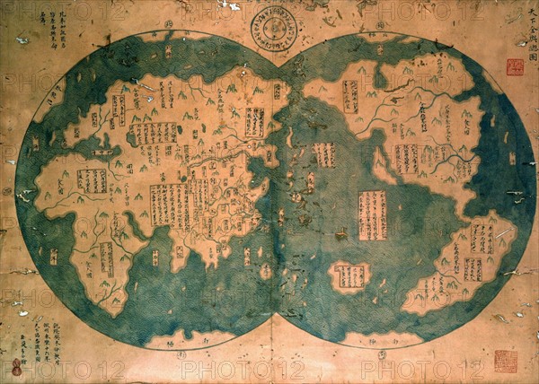
Chinese map of the world dated 1763, claiming to be a reproduction of a 1418 map of Zheng He's (1371-1433) voyages and to prove that Zheng He sailed both to Australia and the Americas. Many think the map is more likely to be based on 18th century European maps. Discovered by Lui Gang in 2005.
Date
18th century
Credit line
Photo12/Ann Ronan Picture Library
Reference
ARP15A01_183
License type
Rights managed
Available size
25,5Mb (2,3Mb) / 11,8in x 8,4in / 3533 x 2523 (300dpi)