Title
Global Positioning System
Caption
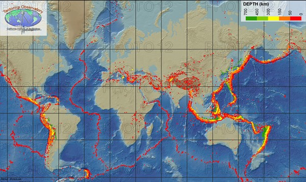
We can measure how fast tectonic plates are moving today with the Global Positioning System (GPS) method. The three most commonly used space-geodetic techniques. very long baseline interferometry (VLBI), satellite laser ranging (SLR), and the Global Positioning System (GPS)are based on technologies developed for military and aerospace research, notably radio astronomy and satellite tracking.
Date
20th century
Credit line
Photo12/Ann Ronan Picture Library
Reference
ARP15A02_097
License type
Rights managed
Available size
51,6Mb (5,0Mb) / 18,3in x 10,9in / 5500 x 3282 (300dpi)