Title
Satellite view of the northern end of the Persian Gulf
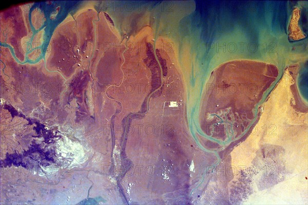
Caption
This image of the northern end of the Persian Gulf and the broad delta complex of the Tigris, Euphrates, Shatt al Arab, and Karun rivers has captured the arid-looking wetlands of northeast Kuwait. February 14, 2000. Satellite image.
Date
20th century
Credit line
Photo12/Ann Ronan Picture Library
Reference
ARP15A06_224
License type
Rights managed
Available size
50,0Mb (4,9Mb) / 17,1in x 11,4in / 5125 x 3410 (300dpi)