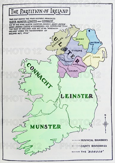
Title
Map of the partition of Ireland
Caption
Map of the partition of Ireland; the division of the island of Ireland into two distinct territories; Northern Ireland and Southern Ireland in 1921
Date
1921
Credit line
Photo12/Ann Ronan Picture Library
Reference
ARP17A26_128
License type
Rights managed
Available size
60,0Mb (2,3Mb) / 12,8in x 18,2in / 3843 x 5457 (300dpi)