Title
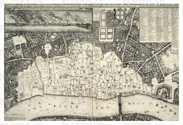
17th Century Map of London
Caption
17th century map of London including the River Thames. At the top of the Map there is an illustration of the Great Fire of London. Dated 1677
Date
1754
Credit line
Photo12/Ann Ronan Picture Library
Reference
ARP18A16_385
License type
Rights managed
Available size
60,0Mb (3,9Mb) / 18,5in x 12,6in / 5542 x 3784 (300dpi)