Title
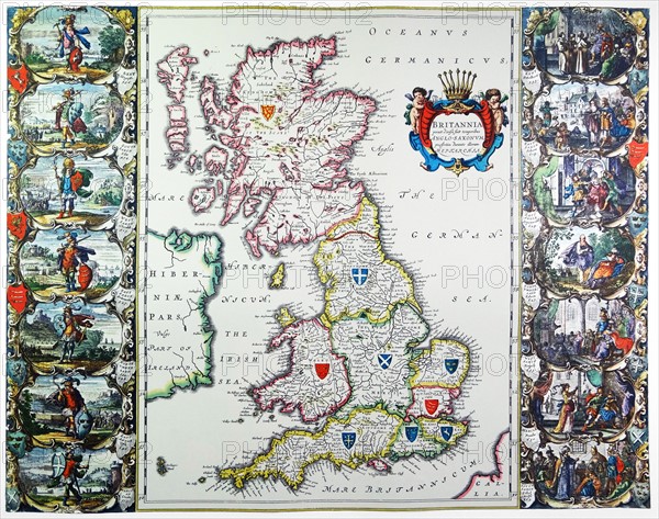
Antique map of Britain. Published 1635
Caption
Antique map of Britain. Published by the Dutch cartographer Willem Blaeu in Atlas Novus (Amsterdam 1635).This map depicts the constituent parts of the United Kingdom created under the Act of Union in 1707
Date
1635
Credit line
Photo12/Ann Ronan Picture Library
Reference
ARP18A27_193
License type
Rights managed
Available size
47,7Mb (5,2Mb) / 15,3in x 12,1in / 4596 x 3624 (300dpi)