Title
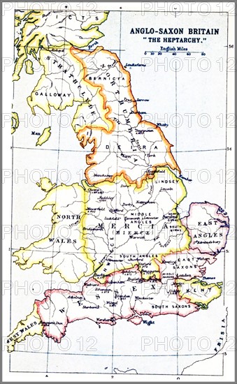
Map showing the Heptarchy of Britain
Caption
1914 Map showing the Heptarchy (from the Greek hepta, seven). The name applied to the Anglo-Saxon kingdoms of south, east, and central England during late antiquity and the early Middle Ages, conventionally identified as seven: Northumbria, Mercia, East Anglia, Essex, Kent, Sussex, and Wessex. The Anglo-Saxon kingdoms eventually unified into the Kingdom of England
Date
1914
Credit line
Photo12/Ann Ronan Picture Library
Reference
ARP18A27_202
License type
Rights managed
Available size
17,7Mb (1,0Mb) / 6,5in x 10,5in / 1954 x 3162 (300dpi)