Title
Map 1576
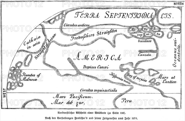
Caption
Map 1576, 16th century, Pacific, Mexico, Peru, Bay, Atlantic, Canada, America, Frobisher, equator, northern waterways, historical illustration 1885, Central America
Date
16th century
Credit line
Photo12/imageBROKER/Wolfgang Diederich
Reference
BRK22B74_305
Model release
NA
Property release
NA
License type
Rights managed
Available size
77,3Mb (2,7Mb) / 21,4in x 14,0in / 6422 x 4205 (300dpi)