Title
Nautical Atlas of the Mediterranean Sea
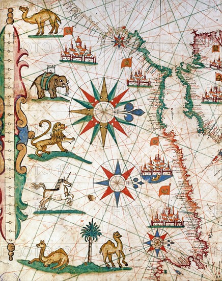
Caption
Petrus Joannes Plums
Nautical Atlas of the Mediterranean Sea in 3 maps. Detail of map No. 1 showing the African coast and the Strait of Gibraltar
1651
Scroll (41.6 x 28 cm)
Venice, Correr Museum.
Date
1651
Credit line
Alfredo Dagli Orti/Photo12
Reference
DGL15A00_139
License type
Rights managed
Available size
149,8Mb (23,6Mb) / 21,5in x 27,1in / 6449 x 8117 (300dpi)