Title
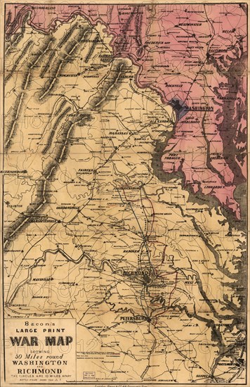
Bacon's Large Print War Map showing 50 miles round Washington and Richmond, Bacon & Co, London, 1864
Caption
Bacon's Large Print War Map showing 50 miles round Washington and Richmond, Bacon & Co, London, 1864
Date
Jan 01, 1864
Credit line
Glasshouse Images/Photo12
Reference
GLS19A06_180
Model release
NA
Property release
NA
License type
Rights managed
Available size
50,1Mb (8,9Mb) / 11,2in x 17,3in / 3369 x 5199 (300dpi)