Title
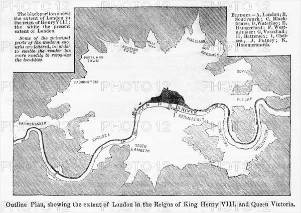
Outline Plan showing the extent of London
Caption
Outline Plan, showing the extent of London in the Reigns of King Henry VIII and Queen Victoria, 16th century, Illustration from the Book, "John Cassel’s Illustrated History of England, Volume II", text by William Howitt, Cassell, Petter, and Galpin, London, 1858
Date
Jan 06, 1858
Credit line
Glasshouse Images/Photo12/JT Vintage
Reference
GLS22A05_321
Model release
No
Property release
No
License type
Rights managed
Available size
50,5Mb (4,5Mb) / 16,6in x 11,8in / 4985 x 3544 (300dpi)
Keywords
map geography towns and cities Thames river nobody no people London England 16th century 19th century illustration historical vintage retro black & white b&w b w horizontal GHIV,
Restrictions
Editorial use only.