Title
'Plan of Metz and its Fortifications', c1872. Creator: R. Walker.
Caption
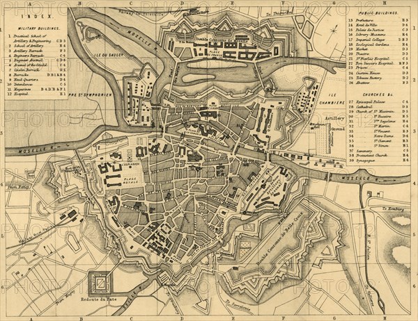
'Plan of Metz and its Fortifications', c1872. Map of the town of Metz (in France), showing 'military buildings, public buildings, churches etc'. The Siege of Metz (19 August-27 October 1870) during the Franco-Prussian War, ended in a decisive Allied German victory. From "The Franco-Prussian War: its causes, incidents and consequences", Volume I, by Captain H M Hozier. [William Mackenzie, London, 1872]
Credit line
Photo12/The Print Collector
Reference
HRM19G32_007
Model release
NA
Property release
NA
License type
Droits gérés
Available size
60,4Mo (5,0Mo) / 44,3cm x 34,1cm / 5232 x 4032 (300dpi)