292 results for: geopark
- Page
-
- of
- 3
Please sign in for more results
BRK25D04_089
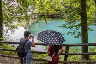
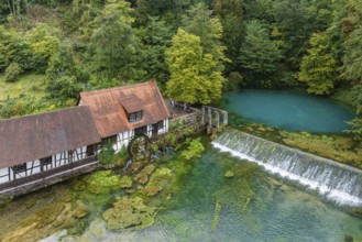
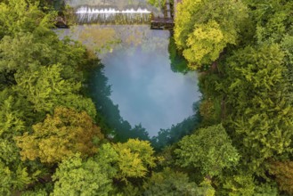
Last photos of the Blautopf in Blaubeuren in front...
BRK25D08_280
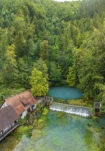
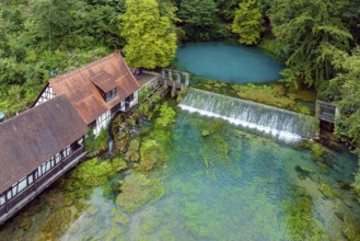
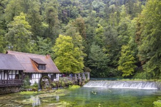
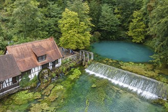
Blautopf Blaubeuren with industrial monument Hamme...
BRK25D04_439
Blautopf Blaubeuren with industrial monument Hamme...
BRK25D06_173
Last photos of the Blautopf in Blaubeuren in front...
BRK25D07_233
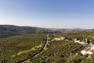
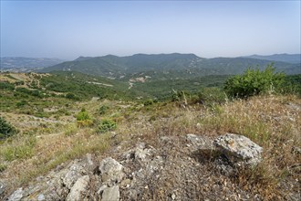
The Gor river valley is grown with cultivated oliv...
BRK25D08_022
Blautopf Blaubeuren with industrial monument Hamme...
BRK25C72_176
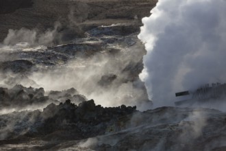
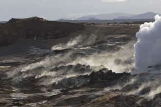
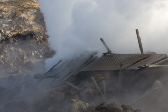
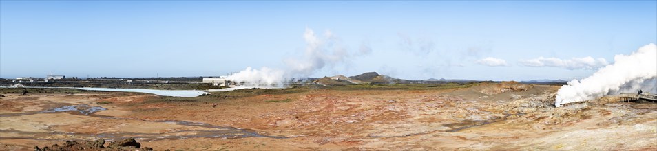
Steam evaporating of the ground at Gunnuhver, clos...
BRK25C56_182
Steam evaporating of the ground at Gunnuhver, clos...
BRK25C96_137
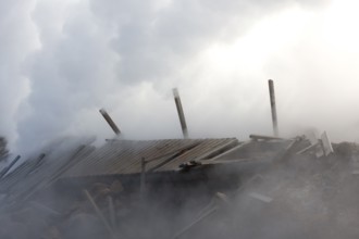
Powerplant.Steam evaporating of the ground at Gunn...
BRK25B57_500
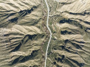
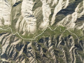
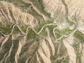
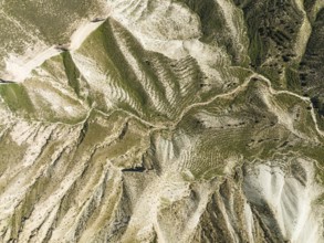
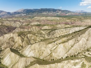
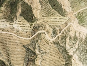
Dirt road in the Gorafe Desert with green surround...
BRK25B58_001
Dirt road in the Gorafe Desert with green surround...
BRK25B55_330
Dirt road in the Gorafe Desert with green surround...
BRK25B62_466
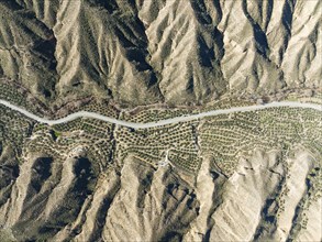
The Gor river valley grown with cultivated olive t...
BRK25B65_452
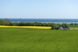
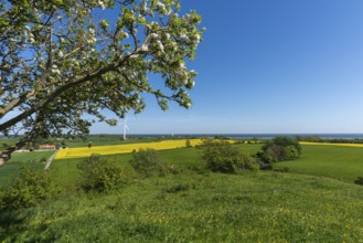
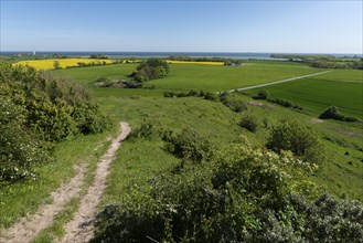
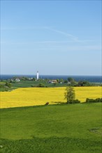
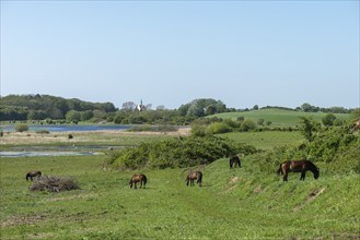
View from Hatbakken Fakkebjerg, Bagenkop, Langelan...
BRK25B76_016
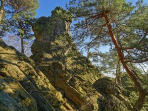
The Dörenther Cliffs, boulders and trees rooted in...
BRK25B55_443
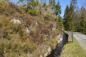
Rehberger Graben, moat, Geopark, St. Andreasberg, ...
BRK25B39_448
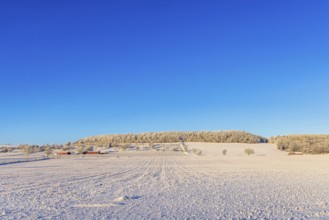
Snowy field by a hill with a red farm a cold sunny...
BRK25B15_380
The Gorafe Desert with green surroundings after so...
BRK25B37_199
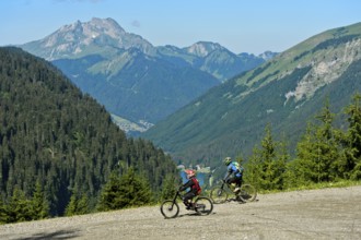
Two mountain bikers on a descent in the Chablais G...
BRK25B17_380
Dirt road in the Gorafe Desert with green surround...
BRK25B17_381
The Gorafe Desert with green surroundings after so...
BRK25B04_324
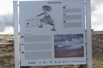
Information plate. Steam evaporating of the ground...
BRK25B07_099
Steam evaporating of the ground at Gunnuhver, clos...
BRK25B12_093
Powerplant.Steam evaporating of the ground at Gunn...
BRK25B03_047
Steam evaporating of the ground at Gunnuhver, clos...
BRK25B44_285
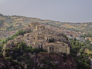
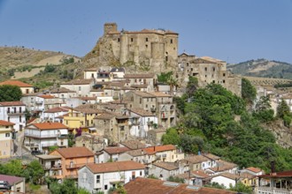
The castle and town of Oriolo, an Italian municipa...
BRK25A55_358
Last photos of the Blautopf in Blaubeuren in front...
BRK25A59_236
Last photos of the Blautopf in Blaubeuren in front...
BRK25A98_284
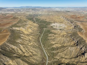
Dirt road and areas of reforestation in the Gorafe...
BRK25A57_488
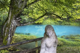
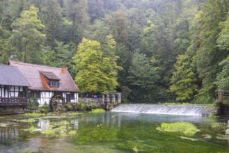
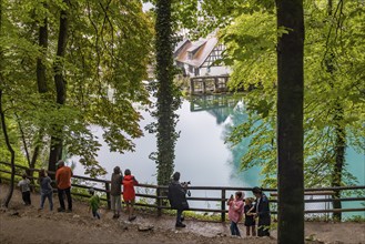
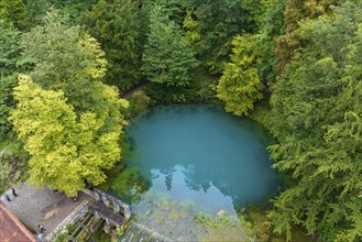
Blautopf Blaubeuren, source of the River Blau in a...
BRK25A54_143
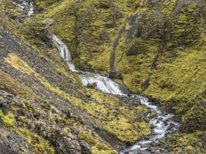
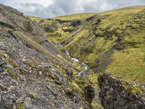
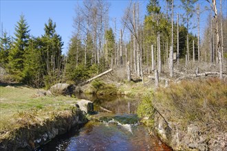
Small river flows in the moss-covered gorge Nauthu...
BRK25A70_002
UNESCO Geopark Sierras Subbéticas, nature park Par...
BRK25A95_470
Rehberger Graben, moat, Geopark, St. Andreasberg, ...
BRK25A31_080
Last photos of the Blautopf in Blaubeuren in front...
BRK25A31_026
The castle and town of Oriolo, an Italian municipa...
BRK25A24_427
View from Hatbakken Fakkebjerg, Bagenkop, Langelan...
BRK24I46_376
Blautopf Blaubeuren with industrial monument Hamme...
BRK24I59_351
The Dörenther Cliffs, boulders and trees rooted in...
BRK24I13_075
Landscape near Castroregio in the Pollino National...
BRK24I22_424
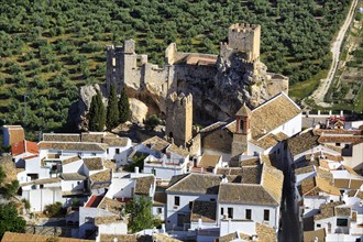
Whitewashed houses, view from above of Moorish-sty...
BRK24H88_322
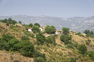
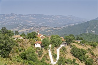
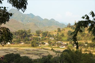
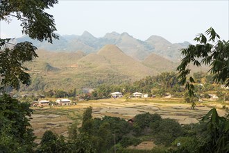
The mountain village of Ferneta is located on a sl...

BRK24H15_226
Last photos of the Blautopf in Blaubeuren in front...
BRK24H42_097
Last photos of the Blautopf in Blaubeuren in front...
BRK24H14_498
Blautopf Blaubeuren, source of the River Blau in a...
BRK24H16_186
Small river flows in the moss-covered gorge Nauthu...
BRK24H45_044
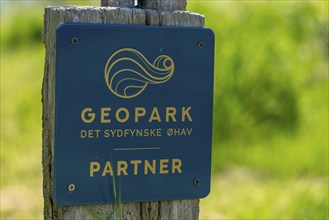
Lindelse, South Funen, information sign, Geopark D...
BRK24H27_288
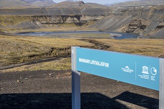
Markarfljotglufur, Markarfljot gorge, road F261 Öl...
BRK24G41_403
The mountain village of Ferneta is located on a sl...

BRK24G06_227
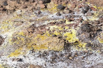
Seven Coloured Earth, 7th coloured earth, Minerals...

BRK24G06_434
Seven Coloured Earth, 7th coloured earth, Minerals...

BRK24G07_040
Seven Coloured Earth, 7th coloured earth, Minerals...

BRK24G06_248
Seven Coloured Earth, 7th coloured earth, Minerals...

BRK24G06_130
Seven Coloured Earth, 7th coloured earth, Minerals...

BRK24G09_432
Seven Coloured Earth, 7th coloured earth, Minerals...
BRK24G02_239
The Gorafe Desert with green surroundings after so...
BRK24G02_240
Dirt road in the Gorafe Desert with green surround...
BRK24G05_016
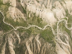
Canyons and gorges cut into the surrounding cultiv...
BRK24F66_211
Last photos of the Blautopf in Blaubeuren in front...
BRK24F70_357
Landscape near Castroregio in the Pollino National...
BRK24F40_439
The Gor river valley is grown with cultivated oliv...
BRK24F42_487
Rehberger Graben, moat, Geopark, St. Andreasberg, ...
BRK24F12_144
Rehberger Graben, moat, Geopark, St. Andreasberg, ...
BRK24E96_303
Rehberger Graben, moat, Geopark, St. Andreasberg, ...
BRK24E81_327
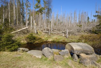
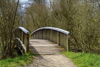
Hiking trail that crosses a bridge over the Große...
BRK24E53_113
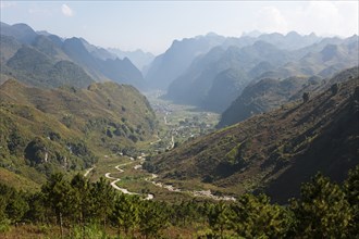
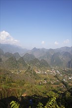
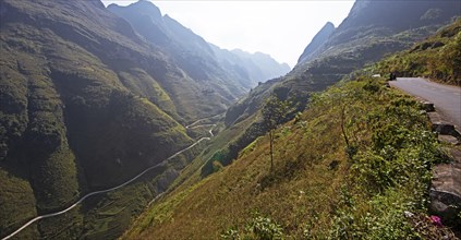
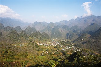
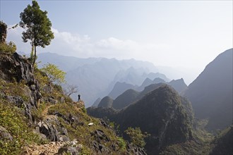
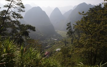
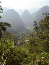
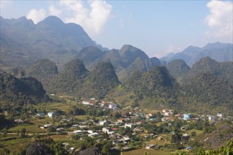
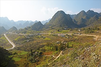
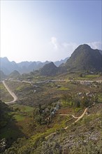
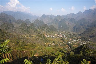
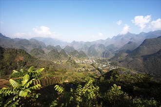
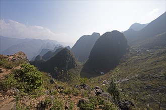
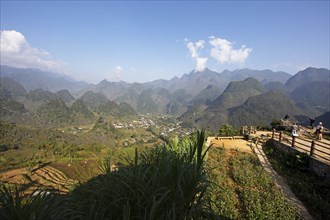
Karst hills and fields, Dong Van Karst Plateau UNE...
BRK24E55_168
Karst rocks in the Dong Van Karst Plateau UNESCO G...
BRK24E53_114
Karst hills and fields, Dong Van Karst Plateau UNE...
BRK24E50_179
Karst hills in the Dong Van Karst Plateau UNESCO G...
BRK24E53_115
Karst hills and fields, Dong Van Karst Plateau UNE...
BRK24E50_325
Karst hills in the Dong Van Karst Plateau UNESCO G...
BRK24E55_171
Karst rocks in the Dong Van Karst Plateau UNESCO G...
BRK24E54_192
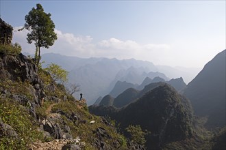
Ma Pi Leng Pass, Dong Van Karst Plateau UNESCO Glo...
BRK24E50_326
Karst hills in the Dong Van Karst Plateau UNESCO G...
BRK24E55_172
Karst rocks in the Dong Van Karst Plateau UNESCO G...

BRK24E42_404
Hiker at an information board about the Mullerthal...
BRK24E55_173
Karst rocks in the Dong Van Karst Plateau UNESCO G...
BRK24E55_174
Karst rocks in the Dong Van Karst Plateau UNESCO G...
BRK24E54_195
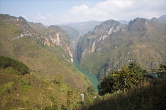
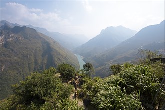
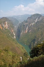
Tu San Gorge and Nho Que River, Dong Van Karst Pla...
BRK24E50_322
Karst hills in the Dong Van Karst Plateau UNESCO G...
BRK24E54_196
Tu San Gorge and Nho Que River, Dong Van Karst Pla...
BRK24E53_118
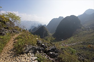
Road and karst rocks in the Dong Van Karst Plateau...
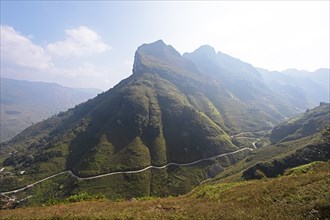
BRK24E54_193
Ma Pi Leng Pass, Dong Van Karst Plateau UNESCO Glo...
BRK24E53_117
Road and karst hills in the Dong Van Karst Plateau...
BRK24E54_194
Tu San Gorge and Nho Que River, Dong Van Karst Pla...
BRK24E50_324
Karst hills in the Dong Van Karst Plateau UNESCO G...
BRK24E50_323
Karst hills in the Dong Van Karst Plateau UNESCO G...
BRK24E54_197
Karst rocks in the Dong Van Karst Plateau UNESCO G...
BRK24E27_314
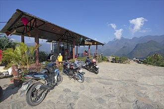
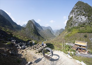
Motorbikes at Lung Ho Viewpoint, Dong Van Karst Pl...
BRK24E54_198
Karst rocks in the Dong Van Karst Plateau UNESCO G...
BRK24E27_313
Karst hill at Lung Ho Viewpoint, Dong Van Karst Pl...
BRK24E55_170
View of the Dong Van UNESCO Global Geopark at the ...
BRK24E13_068
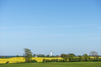
View from Hatbakken Fakkebjerg, Bagenkop, Langelan...
BRK24E13_069
View from Hatbakken Fakkebjerg, Bagenkop, Kelsnor,...
BRK24E13_070
View from Hatbakken Fakkebjerg, Bagenkop, Kelsnor,...
BRK24E13_071
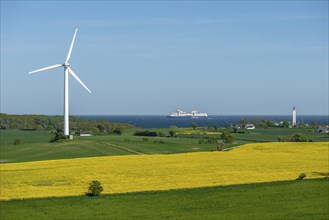
View from Hatbakken Fakkebjerg, Bagenkop, Langelan...
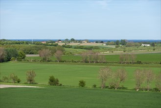
BRK24E13_063
View from Hatbakken Fakkebjerg, Bagenkop, Langelan...
BRK24E13_065
View from Hatbakken Fakkebjerg, Bagenkop, Langelan...
BRK24E09_450
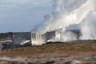
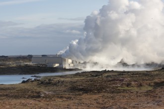
The Gunnuhver geothermal Area in western Iceland
BRK24E08_049
The Gunnuhver geothermal Area in western Iceland

BRK24E13_064
View from Hatbakken Fakkebjerg, Bagenkop, Langelan...
- Page
-
- of
- 3