182 results for: atlases
- Page
-
- of
- 2
Please sign in for more results
LZT20A53_014
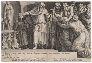
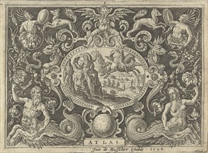
The punishment of Niobe (fifth plate), 1594, coppe...
LZT20A29_399
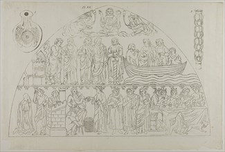
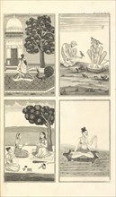
Three Images from Millin’s Atlas, plate XII, 1807–...
LZT20A15_398
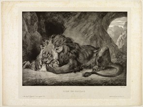
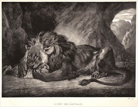
Lion of the Atlas Mountains, 1829, Eugène Delacroi...
LZT20A29_398
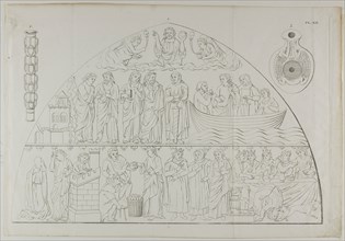
Three Images from Millin’s Atlas, plate XII, 1807–...
LZT20A14_187
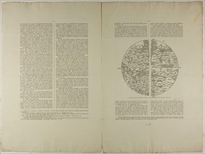
The Geographical Atlas of Ptolemy, 1889, Unknown A...

LZT19B49_423
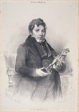
Ferdinand Oldewelt, Portrait of Jacobus van Stolk ...

LZT19B47_500
L.F. Edema van der Tuuk, White marble bust of Gerr...
LZT19B30_261
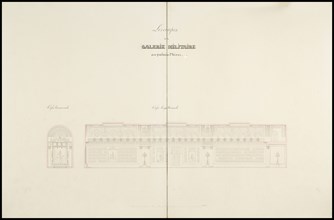
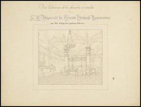
Atlas des plans du Palais d'Hiver de sa Majeste Im...
LZT19B34_446
Allegory of Maritime Atlas, Atlas Maritime, Romeyn...
LZT19B32_317
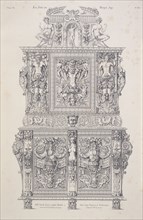
XVIe. siècle: noyer sculpté, meuble à deux corps, ...
LZT19B32_030
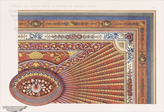
Plafond: Faïences et autres détails algériens, det...
LZT19B32_318
A. du Sommerard, Les arts au Moyen Age: en ce qui ...
LZT19A85_231
Studies of a Statuette of Atlas and a Figure Prayi...

LZT19B36_048
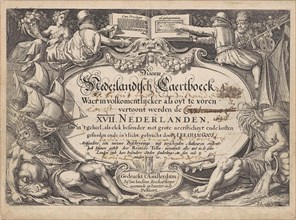
Atlas historique, ou, Nouvelle introduction a l'hi...

LZT19B36_049
Atlas historique, ou, Nouvelle introduction a l'hi...
LZT19B38_142
Atlas historique, ou, Nouvelle introduction a l'hi...
LZT19B02_225
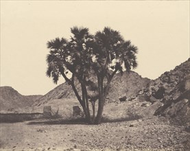
Egypte et Nubie. Sites et Monuments...Atlas Photog...
LZT19B30_260
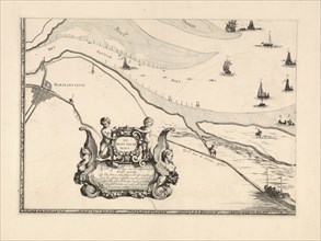
Vue intérieure de la chambre à coucher, Atlas des ...

LZT19A47_306
Lion de l'Atlas, 1829. Eugène Delacroix (French, 1...
LZT19A82_150
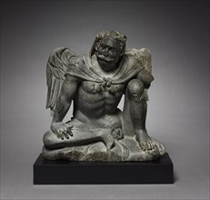
Winged Atlas Figure, 200s. Pakistan, Gandhara, Gan...
LZT16A21_393
Eugène Delacroix (French, 1798 - 1863). Lion of t...
LZT16A02_307
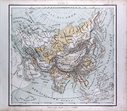
Asia Map, atlas by Th. von Liechtenstern and Henry...
LZT16A02_316
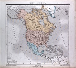
North America Map, atlas by Th. von Liechtenstern ...
LZT16A27_439
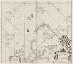
Sea chart of the Baltic and North Sea, Jan Luyken,...
LZT16A02_306
Asia Map, atlas by Th. von Liechtenstern and Henry...
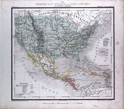
LZT16A02_317
North American and Central America, atlas by Th. v...
LZT16A26_177
Cartouche: Atlas turns into a mountain, Abraham de...
LZT16A02_287
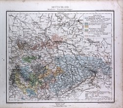
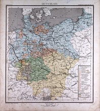
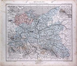
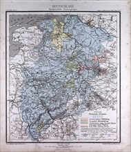
Germany, Deutschland, atlas by Th. von Liechtenste...
LZT16A02_296
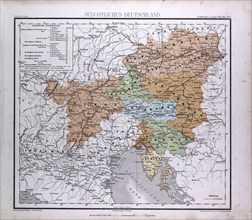
South East Germany, Sudostliches Deutschland, atla...
LZT16A27_441
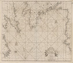
Sea chart of part of the coast of Ireland, England...
LZT16A02_297
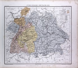
South West Germany, Sudwestliches Deutschland, atl...
LZT16A02_286
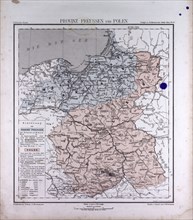
Germany, Prussia, Poland, atlas by Th. von Liechte...
LZT16A39_340
Map of Maassluis and the banks of the Meuse, The N...
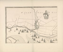
LZT16A39_341
Map of Brielle and the banks of the Meuse, The Net...
LZT16A31_305
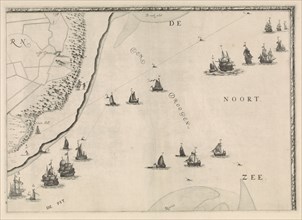
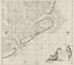
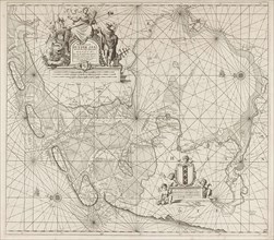
Map of the North Sea and the coast of Holland, Jac...

LZT16A33_463
Woman Reading a Letter, Willem Steelink (I), Johan...
LZT16A27_423
Sea chart of part of north east coast of Scotland ...
LZT16A02_308
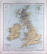
Great Britain and Ireland, atlas by Th. von Liecht...
LZT16A25_227
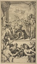
Hercules takes the globe of Atlas and bears him on...
LZT16A02_281
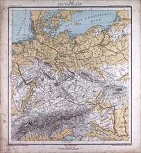
Germany, atlas by Th. von Liechtenstern and Henry ...
LZT16A02_290
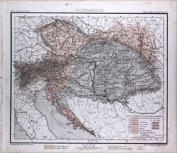
Austria, Oesterreich, atlas by Th. von Liechtenste...
LZT16A02_299
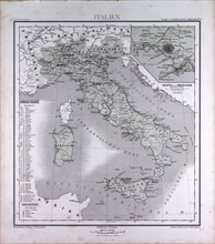
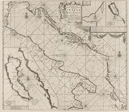
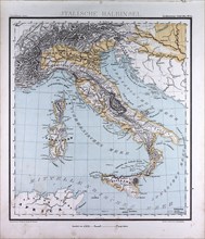
Italy, atlas by Th. von Liechtenstern and Henry La...

LZT16A24_201
Self Portrait, Samuel van Hoogstraten, 1677
LZT16A02_309
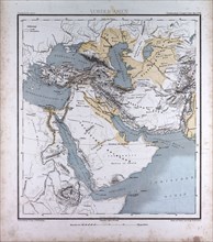
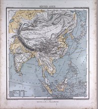
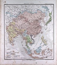
Western Asia or West Asia, atlas by Th. von Liecht...
LZT16A02_280
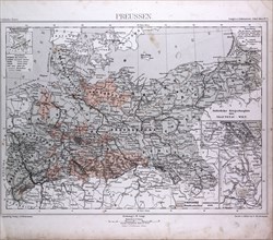
Prussia, Preussen, atlas by Th. von Liechtenstern ...
LZT16A02_291
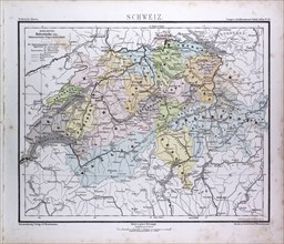
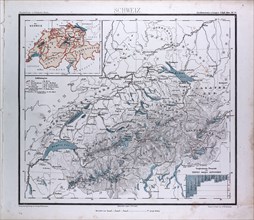
Switzerland, atlas by Th. von Liechtenstern and He...
LZT16A02_298
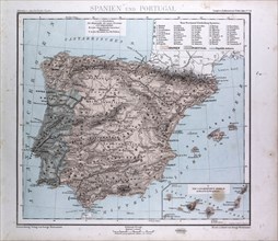
Spain and Portugal Map, atlas by Th. von Liechtens...
LZT16A27_374
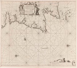
Map of the coasts of the Adriatic, print maker: An...
LZT16A37_071
River and sea gods with tradesmen, Pieter Serwoute...
LZT16A02_310
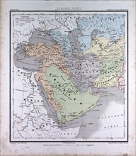
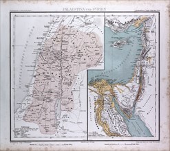
Israel, Syria, Palestina, atlas by Th. von Liechte...
LZT16A02_279
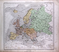
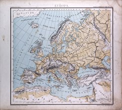
Europe, Europa, atlas by Th. von Liechtenstern and...
LZT16A02_288
Germany, Deutschland, atlas by Th. von Liechtenste...
LZT16A02_301
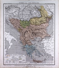
Turkey and Greece, atlas by Th. von Liechtenstern ...
LZT16A24_114
Allegory of the East Indies, Jan Caspar Philips, 1...
LZT16A27_436
Sea chart of the Wadden Sea from Den Helder to Ter...
LZT16A02_311
Western Asia or West Asia, atlas by Th. von Liecht...
LZT16A02_289
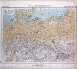
North and Middle Germany, Nord und Mittel Deutschl...
LZT16A02_300
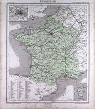
France, atlas by Th. von Liechtenstern and Henry L...
LZT16A27_437
Sea chart of the Zuiderzee and the Wadden Sea, Jan...
LZT16A02_312
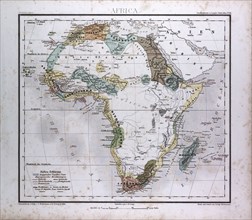
Africa Map, atlas by Th. von Liechtenstern and Hen...
LZT16A02_321
Italy, atlas by Th. von Liechtenstern and Henry La...
LZT16A02_294
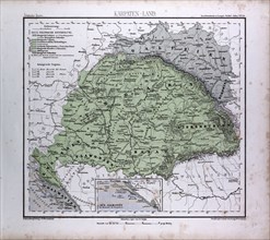
Carpathian Mountains, Karpaten, Karpaty, Atlas by ...
LZT16A02_303
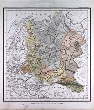
Russia, atlas by Th. von Liechtenstern and Henry L...
LZT16A02_285
Europe, atlas by Th. von Liechtenstern and Henry L...
LZT16A02_313
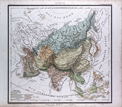
Asia, atlas by Th. von Liechtenstern and Henry Lan...
LZT16A02_320
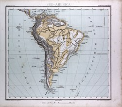
South America Map, atlas by Th. von Liechtenstern ...
LZT16A02_295
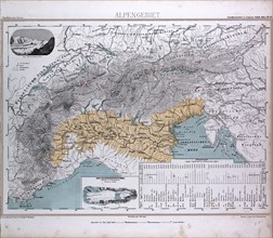
Alps, Alpengebiet, atlas by Th. von Liechtenstern ...
LZT16A02_302
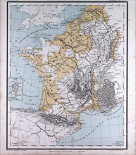
Europe, France, Belgium, The Netherlands, atlas by...
LZT16A02_284
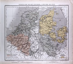
The Netherlands, Belgium, Danmark, Schleswig-Holst...
LZT16A02_305
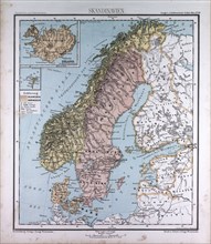
Scandinavia, Northern Europe, atlas by Th. von Lie...
LZT16A02_314
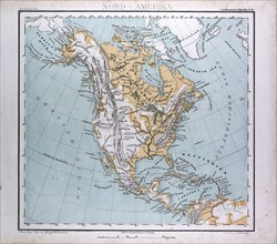
North America Map, atlas by Th. von Liechtenstern ...
LZT16A02_319
South America Map, atlas by Th. von Liechtenstern ...
LZT16A02_292
Germany, atlas by Th. von Liechtenstern and Henry ...
LZT16A02_283
Germany, atlas by Th. von Liechtenstern and Henry ...
LZT16A02_315
Asia, atlas by Th. von Liechtenstern and Henry Lan...
LZT16A02_318
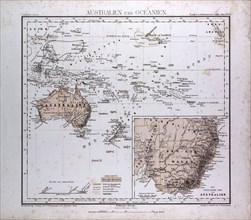
Australia and Oceania Map, atlas by Th. von Liecht...
LZT16A02_293
Switzerland, Schweiz, atlas by Th. von Liechtenste...
LZT16A02_304
Great Britain and Ireland, atlas by Th. von Liecht...
LZT16A27_359
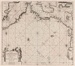
Sea chart of the coasts of Colombia, Panama, Costa...
LZT16A02_282
Earth Map, atlas by Th. von Liechtenstern and Henr...
LZT16A63_103
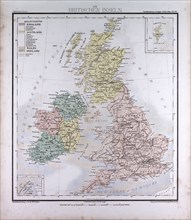
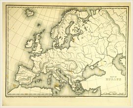
Mitchell's Atlas of outline maps, Europe, 19th cen...
LZT16A87_153
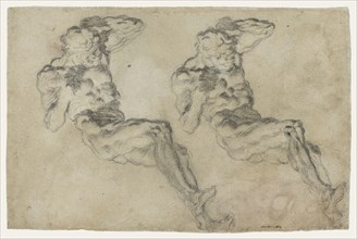
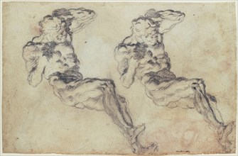
Studies of a Statuette of Atlas (recto), Studies ...

LZT16A53_079
Eugène Delacroix (French, 1798 - 1863), Atlas's L...
LZT16A63_108
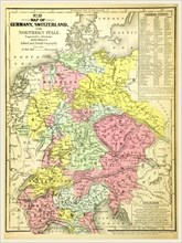
Map of Germany and Switzerland, 19th century engra...
LZT16A74_212
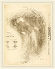
Henri Bataille, French (1872-1922), Ton Sang, c. 1...
LZT16A62_490
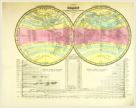
Atlas, Chart of climates, 19th century engraving
LZT16A62_227
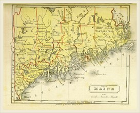
Part of Maine, US, The Boston School Atlas, 19th c...
LZT16A63_123
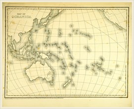
Mitchell's Atlas of outline maps, map of Oceanica,...
LZT16A62_228
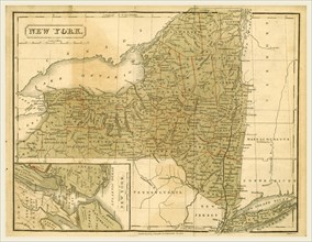
Map New York, The Boston School Atlas, US, America...
LZT16A62_235
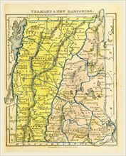
Vermont and New Hampshire, the Boston School Atlas...
LZT16A62_147
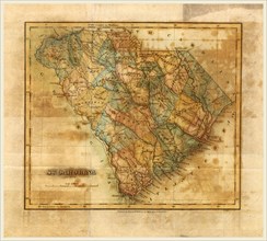
Map South Carolina, Mills Atlas, US, America, 19th...
LZT16A63_127
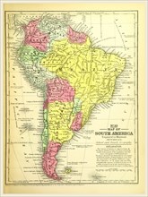
Map of South America, 19th century engraving, Mitc...
LZT16A62_234
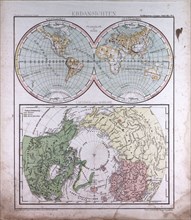
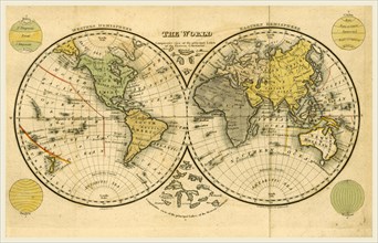
World map, The Boston School Atlas, US, America, 1...
LZT16A65_160
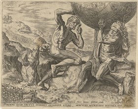
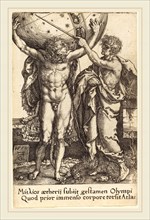
Heinrich Aldegrever (German, 1502-1555-1561), Herc...
LZT16A52_273
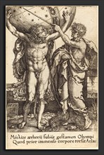
Heinrich Aldegrever (German, 1502 - 1555-1561), He...
LZT13A39_032
MAP OF NEW YORK ABOUT THE MIDDLE OF THE EIGHTEENTH...
LZT13A39_055
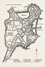
A PLAN OF BOSTON, UNITED STATES OF AMERICA, From F...
LZT13A39_312
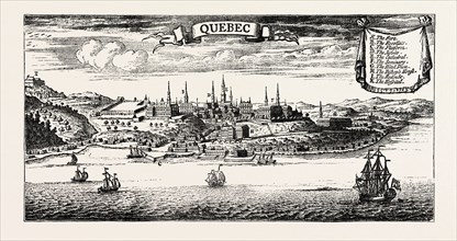
OLD VIEW OF QUEBEC, from Popple' s American Atlas,...
LZT13A39_324
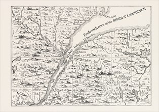
THE COURSE OF THE RIVER ST. LAWRENCE AS FAR AS QUE...
LZT13A39_349
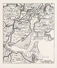
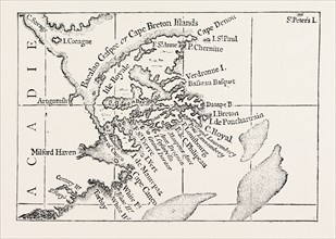
MAP OF CAPE BRETON. From Popple' s Atlas. CANADA, ...
- Page
-
- of
- 2