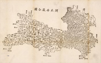
207 résultats pour : map. asia
- Page
-
- sur
- 3
Connectez-vous pour plus de résultats
UMG25A06_181
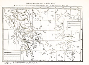
This geogrpahical and historical outline maps show...
UMG25A06_182
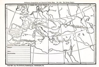
This geographical and historical outline map focus...
UMG25A01_161
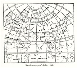
This Russian map shows how they pictured Asia in ...
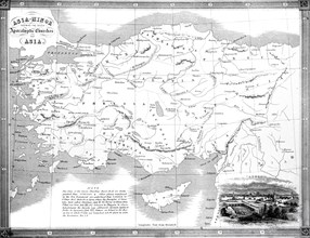
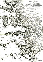
UMG25A01_204
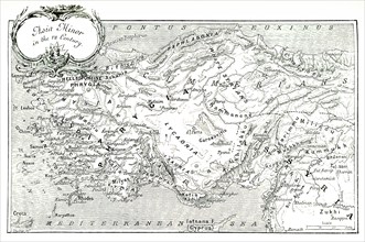
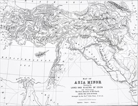
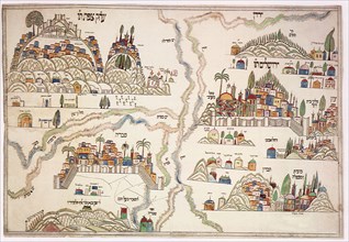
This 1903 illustration shows a map of Asia Minor (...
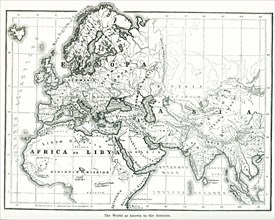
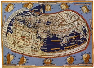
UMG24A06_490
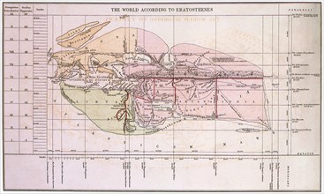
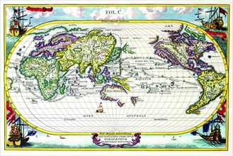
This map shows the world as it was known to the an...
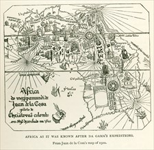
UMG24A06_497
This image shows Africa as it was known after DaGa...
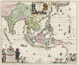
UMG23A61_155
Map of South-East Asia.
UMG23A57_177
A Map Of The Seven Apocalyptic Churches Of Asia.
UMG23A62_303
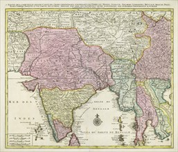
Map of India and Southern Asia dating from 1792.
UMG23A57_178
Map Of Asia Minor Showing Rivers Of Eden.
UMG22A55_423
Propaganda Posters
UMG22A55_424
Propaganda Posters
UMG22A49_194
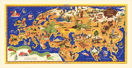
Grand Circuit des Capitales
UMG22A32_142
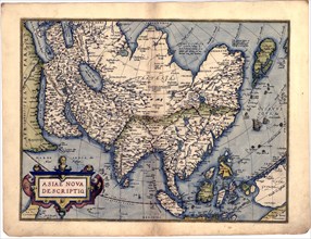
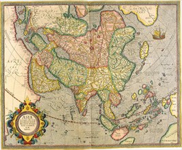
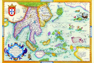
Abraham Ortelius - First World Atlas ca. 1570 - As...
UMG22A25_002
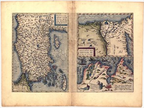
Abraham Ortelius - First World Atlas ca. 1570 - Na...
UMG22A07_161
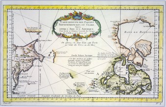
Reduced map of the northern parts of the world
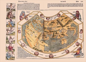
UMG21A17_195
Ptolemaic World, 1482
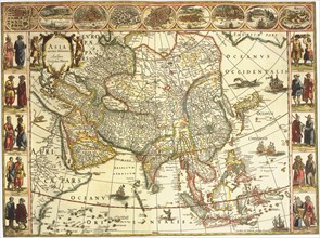
UMG21A18_171
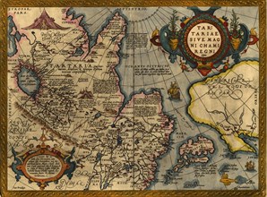
Map of Asian Continent 1617
UMG21A17_296
Inland Indian Ocean 1493
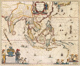
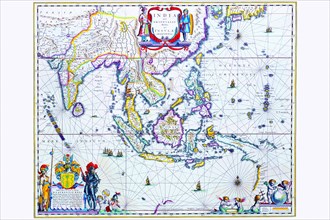
UMG21A18_172
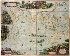
Map of East Indies 1635
UMG21A17_085
Japan, 1747
UMG21A17_182
Constantinople, Byzantium
UMG21A17_189
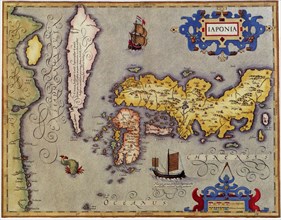
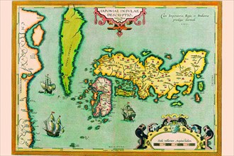
Japan, 1606
UMG21A18_096
Early World Map
UMG21A18_099
Map of Mesopotamia 1650
UMG21A17_178
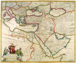
Turkish Empire
UMG21A17_084
Empire of the Great Mogul
UMG21A17_333
Map of Asia 1617
UMG21A17_361
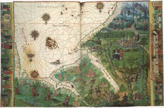
Indian Ocean 1670
UMG21A17_388
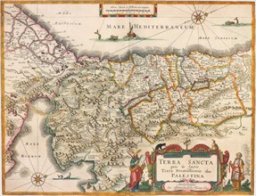
Map of the Holy Land and Routes 1662
UMG21A17_259
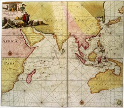
Indian Ocean, Australia & the Orient
UMG21A17_387
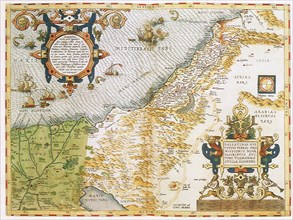
Map of the Judaica Holy Land 1575
UMG21A17_346
Map of Palestine 1486
UMG21A17_390
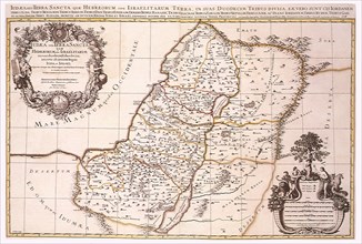
Map of Israel's Twelve Tribes 1696
UMG21A17_314
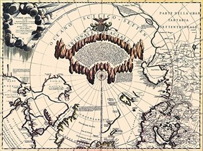
Map of the North Pole 1690
UMG21A17_345
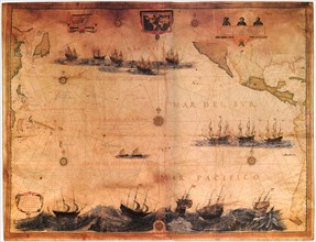
Map of the Pacific 1622
UMG21A17_356
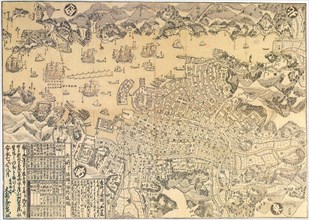
Map of Nagasaki.

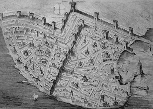
UMG21A17_389
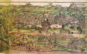
Map of Sixteenth-Century Jerusalem 1612
UMG21A18_155
Map of East Africa etc 1547
UMG21A18_173
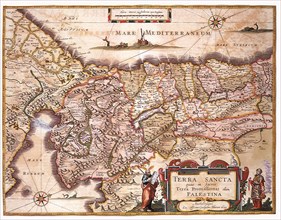
Map of Palestine 1629
UMG21A17_220
South East Asia 1570
UMG21A17_391
Religio-Historical Map of the Holy Cities 1870
UMG21A18_166
Map of Persia 1645
UMG21A17_075
The World
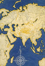
UMG21A17_205
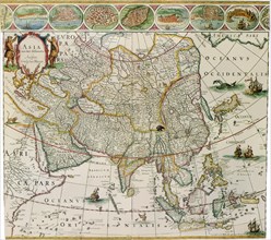
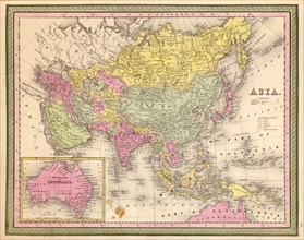
Asia
UMG21A17_258
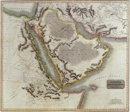
Arabia
UMG21A17_074
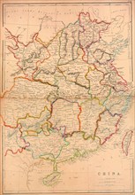
China
UMG21A17_327
Near East Map 1606
UMG20B49_153
The crusades were a series of religious wars in we...
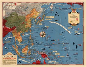
UMG20B31_180
On To Tokyo
UMG20B27_406
Minor asia coast
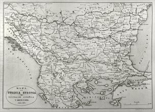
UMG20B25_363
The Eastern Question
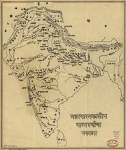
UMG20B18_222
MAP-INDIA

UMG20A49_041
Finest in the World 1885
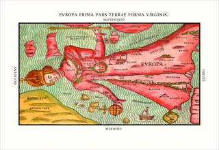
UMG20A00_034
Europa Prima Pars 1580
UMG20A00_058
Orbis Terrarum Typus 1596
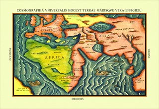
UMG20A00_037
Cosmographia Universalis 1580
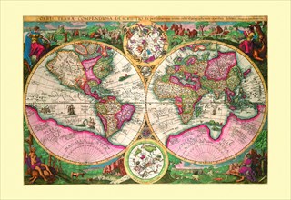
UMG20A00_313
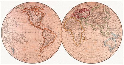
New map of the world : with all the new discoverie...
UMG20A00_055
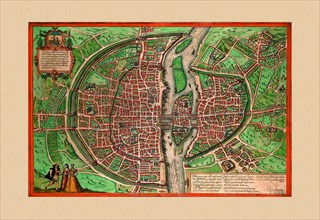
Lutiti Paris 1572
UMG20A12_340
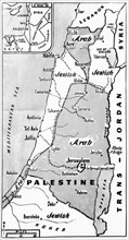
Palestine State Proposal
UMG20A00_337
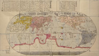
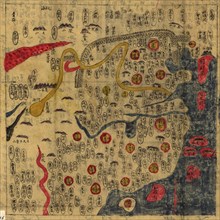
Chinese Medieval World Map
UMG20A00_348
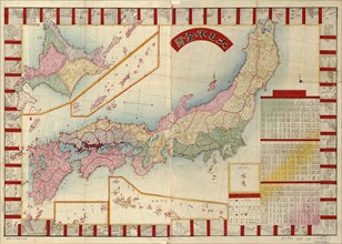
Japan 1888
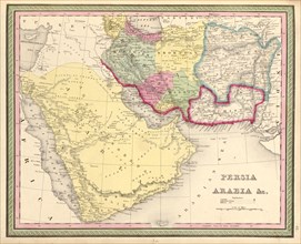
UMG20A02_180
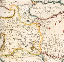
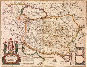
Persia & Arabia - 1849
UMG20A04_138
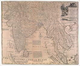
India & Southeast Asia 1650
UMG20A00_338
Map of India
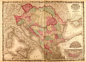
UMG20A01_160
Austria & Turkey In Europe - 1862
UMG20A04_137
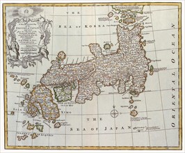
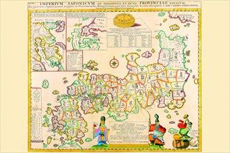
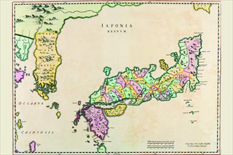
Prefectures & the Peoples of Japan 1727
UMG20A00_339
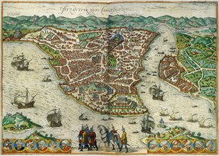
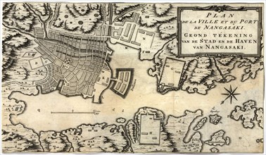
City Plan of Nagasaki, Japan in the 18th Century 1...
UMG20A00_350
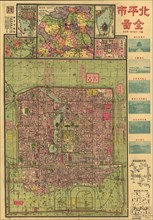
Beijing 1921 City Map 1921
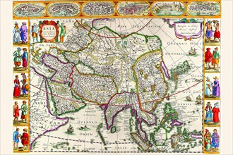
UMG20A02_134
Asia - 1570 1570
UMG20A02_143
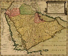
Three Arabias - 1654 1654
UMG20A02_178
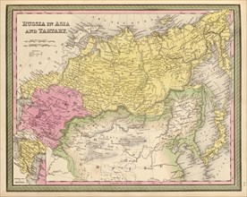
Russia in Asia & Tartary - 1849
UMG20A04_104
Navigationes Precipae Europorum ad Exteras Natione...
UMG20A04_136
Japan & Korea 1655
UMG20A00_331
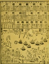
Perry arrives in Uraga, Soshu Province 1871
UMG20A00_340
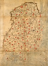
Map of Korea
UMG20A00_349
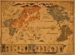
Japanese Woodblock map Based on Matteo Ricci's Wor...
UMG20A02_133
Asia - 1680 1680
UMG20A02_144
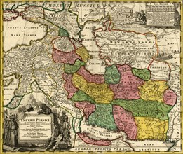
Imperial Persia - Iran - 1724
UMG20A02_179
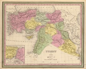
Turkey in Asia - 1849
UMG20A04_135
Description of the Japanese Islands 1590
UMG20A00_333
People of Many Nations 1850
UMG20A00_363
China 1864
UMG20A00_372
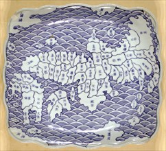
Porcelain plat map of Japan 1835
UMG20A04_134
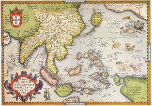
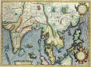
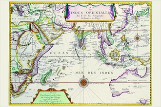
East Indies by Ortelius 1590
UMG20A04_141
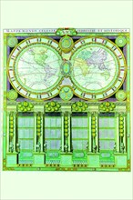
Mappe-Monde Celeste Terrestre et Historique; Stere...
UMG20A00_334
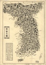
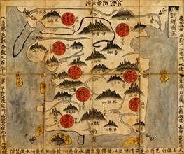
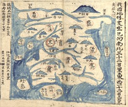
Ancient Map of Korea

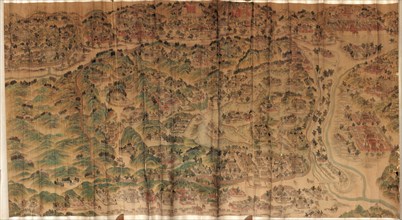
UMG20A00_362
Chinese Summer Palace 1888
UMG20A00_373
Musashi Village(Edo) 1804
UMG20A02_177
Asia - 1849
UMG20A04_133
Indies Orientales; Southeast Asia 1680
UMG20A00_335
Ancient Map of Korea
UMG20A00_383
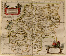
Szechuan, China 1655
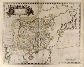
UMG20A04_132
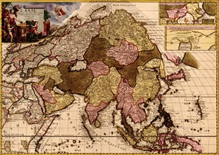
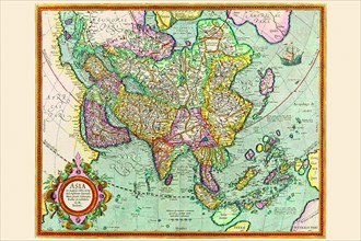
Asia 1620
UMG20A00_336
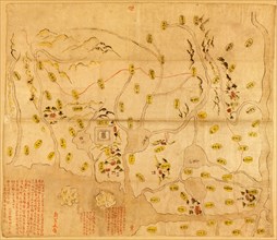
Chinese Map
UMG20A00_382
Empires Of Japan, China & Korea 1655
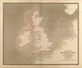
UMG20A02_104
British Isles, Waves, High Water & Tides 1848
UMG20A04_131
Asia 1632
UMG20A00_358
Map of Empire Palace in Rehol. 1750
UMG20A00_368
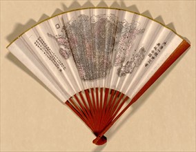
Fan Map of Japan, China & Korea 1890
- Page
-
- sur
- 3