Sujet
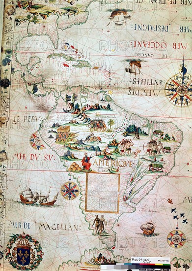
French map of Central and South America
Légende
French map of Central and South America, showing Florida, Gulf of Mexico, Caribbean Islands and Antilles, River Plate, Conquistadors in Peru, Cannibals, Gold Mines, Parrots, etc. 1550. British Museum
Info+
Photos12.com - Ann Ronan Picture Library
Crédit
Photo12/Ann Ronan Picture Library
Notre référence
ARP07098_390003127
Licence
Droits gérés
Format disponible
25,6Mo (2,9Mo) / 21,3cm x 30,0cm / 2521 x 3543 (300dpi)