Sujet
NASA's Uninhabited Aerial Vehicle Synthetic Aperture Radar
Légende
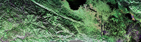
NASA's Uninhabited Aerial Vehicle Synthetic Aperture Radar (UAVSAR) captured this false-colour composite image of the city of Port-au-Prince, Haiti, and the surrounding region on Jan. 27, 2010. Port-au-Prince is visible near the centre of the image (denoted by the yellow arrow on the annotated image above). The large dark line running east-west near the city is the main airport. UAVSAR left NASA's Dryden Flight Research Centre in Edwards, Calif., Jan. 25, 2010, aboard a modified NASA Gulfstream III aircraft on a three-week campaign that will also take it to Central America.
Date
20e siècle
Crédit
Photo12/Ann Ronan Picture Library
Notre référence
ARP15A02_075
Licence
Droits gérés
Format disponible
50,9Mo (7,4Mo) / 65,1cm x 19,6cm / 7685 x 2313 (300dpi)