Sujet
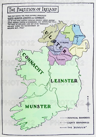
Map of the partition of Ireland
Légende
Map of the partition of Ireland; the division of the island of Ireland into two distinct territories; Northern Ireland and Southern Ireland in 1921
Date
1921
Crédit
Photo12/Ann Ronan Picture Library
Notre référence
ARP17A26_128
Licence
Droits gérés
Format disponible
60,0Mo (2,3Mo) / 32,5cm x 46,2cm / 3843 x 5457 (300dpi)