même sujet
Nativesusa12
Sujet
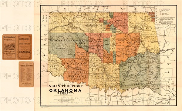
Map of the Indian Territory showing Oklahoma Country
Légende
Map of the Indian Territory showing Oklahoma Country, Rand, McNally & Co's., 1889
Date
06 janv. 1889
Crédit
Glasshouse Images/Photo12/Circa Images
Notre référence
GLS20A02_305
Model release
NA
Property release
NA
Licence
Droits gérés
Format disponible
51,5Mo (8,4Mo) / 45,8cm x 28,2cm / 5412 x 3325 (300dpi)