même sujet
Nativesusa12
Sujet
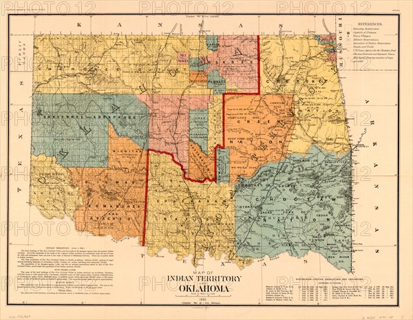
Map of Indian Territory and Oklahoma
Légende
Map of Indian Territory and Oklahoma, U.S. Bureau of the Census, 1890
Date
06 janv. 1890
Crédit
Glasshouse Images/Photo12/Circa Images
Notre référence
GLS20A02_306
Model release
NA
Property release
NA
Licence
Droits gérés
Format disponible
50,1Mo (9,9Mo) / 40,2cm x 31,2cm / 4748 x 3685 (300dpi)