Sujet
Map of London, 1727. Artist: Anon
Légende
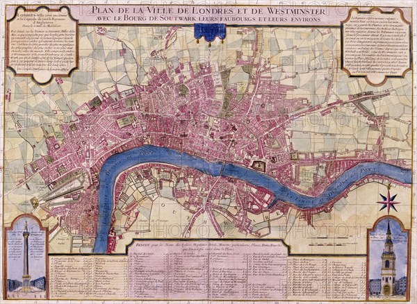
Map of London, 1727. French map of the City of London, City of Westminster, River Thames, Lambeth, Southwark and surrounding areas. Bottom left inset shows the Monument, bottom right inset shows St Mary-le-Bow, with a key in the centre.
Date
1727
Crédit
Photo12/Heritage Images/City of London : The London Archives
Notre référence
HRM19A76_237
Model release
NA
Property release
NA
Licence
Droits gérés
Format disponible
49,1Mo (4,0Mo) / 41,0cm x 30,0cm / 4843 x 3541 (300dpi)