Sujet
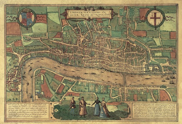
Earliest printed map of London, 1574. Artist: Unknown
Légende
Earliest printed map of London, 1574. The palace at Westminster can be seen on the left, and the Tower of London on the right, with ships on the Thames. London Bridge was the only bridge over the river at the time. The new Royal Exchange, built in 1570, is shown, but so is St Paul's spire which had been destroyed by lightning in 1561. From the second edition of a German atlas of European cities by Braun and Hogenberg.
Museum of London
Date
1574
Crédit
Photo12/Heritage Images/London Museum
Notre référence
HRM19A83_052
Model release
Non
Licence
Droits gérés
Format disponible
47,6Mo (4,6Mo) / 41,8cm x 28,5cm / 4939 x 3366 (300dpi)