Sujet
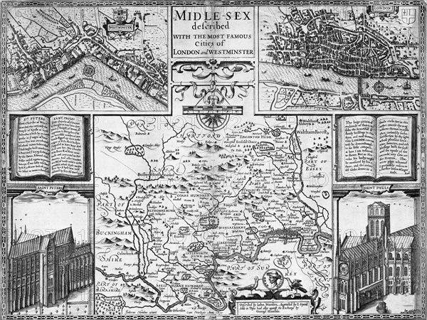
Map of London, Westminster and Middlesex, late 16th-early 17th century. Artist: John Speed
Légende
Map of London, Westminster and Middlesex, late 16th-early 17th century. The cities of London and Westminster were two separate centres at the time, and people travelled between by boat down the River Thames. Parts of the surrounding counties of Berkshire, Surrey, Buckinghamshire, Essex, Kent and Hartfordshire are also shown.
Museum of London
Date
1570
Crédit
Photo12/Heritage Images/London Museum
Notre référence
HRM19A84_079
Model release
Non
Licence
Droits gérés
Format disponible
54,0Mo (3,6Mo) / 42,5cm x 31,9cm / 5016 x 3764 (300dpi)