Sujet
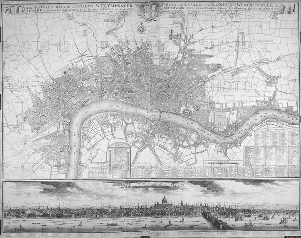
Map of Westminster, the City of London, Southwark, the Thames and surrounding areas, 1710. Artist: Anon
Légende
Map of Westminster, the City of London, Southwark, the Thames and surrounding areas, 1710. With tables of public offices, wards, parishes, livery halls and companies, markets, inns of court, prisons, palaces, public buildings and hospitals at the foot of the map, and in the bottom margin a prospect of the City and Westminster with a key below to significant landmarks.
Date
1710
Crédit
Photo12/Heritage Images/City of London : The London Archives
Notre référence
HRM19A97_170
Model release
NA
Property release
NA
Licence
Droits gérés
Format disponible
18,0Mo (1,3Mo) / 23,9cm x 18,9cm / 2819 x 2230 (300dpi)