Sujet
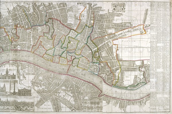
Map of Westminster, the City of London, Southwark and surrounding areas, 1743. Artist: Anon
Légende
Map of Westminster, the City of London, Southwark and surrounding areas, 1743. With inset images of the Banqueting House at Whitehall, the Treasury, the Royal Exchange, the Bank of England and a south prospect of the City. Two reference tables appear in the side margins and lists of watermen's and hackney coach fares and the arms of twelve principal livery companies.
Date
1743
Crédit
Photo12/Heritage Images/City of London : The London Archives
Notre référence
HRM19A97_197
Model release
NA
Property release
NA
Licence
Droits gérés
Format disponible
18,0Mo (1,7Mo) / 26,0cm x 17,3cm / 3074 x 2046 (300dpi)