Sujet
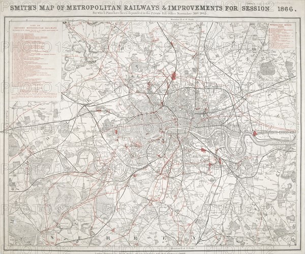
Map of Greater London showing the Metropolitan Railways and improvements in 1866. Artist: Anon
Légende
Map of Greater London showing the Metropolitan Railways and improvements in 1866. With a table inset listing the proposed lines. Completed railways are shown in a firm black line, with those in progress or sanctioned represented by a pecked black line. Proposed new lines are shown in red.
Date
1866
Crédit
Photo12/Heritage Images/City of London : The London Archives
Notre référence
HRM19A97_410
Model release
NA
Property release
NA
Licence
Droits gérés
Format disponible
18,0Mo (1,3Mo) / 23,3cm x 19,4cm / 2747 x 2290 (300dpi)