Sujet
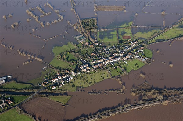
Aerial view of flooding around East Lyng, Somerset Levels, January, 2014
Légende
Flooding around East Lyng, Somerset, 2014. At the end of the 9th century AD King Alfred the Great established a burh, or fortified settlement, at the eastern end of the Lyng ridge. The town was linked to the nearby stronghold and monastery at Athelney, founded by Alfred a few years earlier, and all were surrounded by the marshes of the Somerset Levels. This image, taken at the height of the flooding in the winter of 2013-2014, shows the logic behind the location of the settlement, now called East Lyng.
Date
2014
Crédit
Photo12/Heritage Images/Historic England Archive
Notre référence
HRM19B38_039
Model release
Non
Licence
Droits gérés
Format disponible
50,0Mo (3,0Mo) / 43,3cm x 28,9cm / 5120 x 3413 (300dpi)