Sujet
Use of the magnetic compass in map making, 1643. Artist: Unknown
Légende
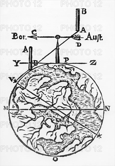
Use of the magnetic compass in map making, 1643. Diagram of the use of the compass by cartographers and surveyors. 'Bor' (Borealis) is north and 'Aust' (Australis) is south. From Magnes: sive de arte magnetica by Athanasius Kircher. (Rome, 1643).
Oxford Science Archive
Date
1643
Crédit
Photo12/Heritage Images
Notre référence
HRM19B66_206
Model release
Non
Licence
Droits gérés
Format disponible
50,0Mo (1,3Mo) / 29,5cm x 42,4cm / 3485 x 5013 (300dpi)