Sujet
Map of Antietam, Sharpsburg and Vicinity, Maryland, 1862 (1862-1867).Artist: Rae Smith
Légende
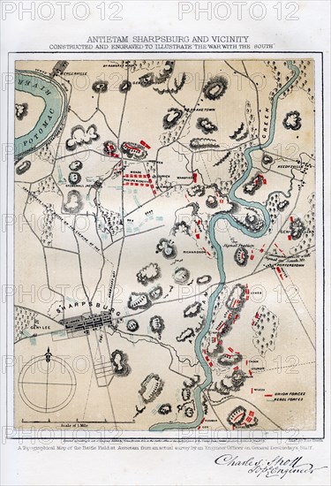
Map of Antietam, Sharpsburg and Vicinity, Maryland, 1862 (1862-1867) The Battle of Antietam, fought on 17 September 1862, was the first battle of the American Civil War to be fought on Union (northern) soil. It was the bloodiest single day battle in American history, with nearly 23,000 casualties. An engraving from volume II of The War with the South : a History of the Late Rebellion, by Robert Tomes, Benjamin G Smith, New York, Virtue & Yorston, 3 Volumes, 1862-1867.
The Print Collector collection
Date
1862
Crédit
Photo12/Heritage Images/The Print Collector
Notre référence
HRM19C17_374
Model release
Non
Licence
Droits gérés
Format disponible
49,9Mo (3,4Mo) / 29,2cm x 42,8cm / 3451 x 5050 (300dpi)