Sujet
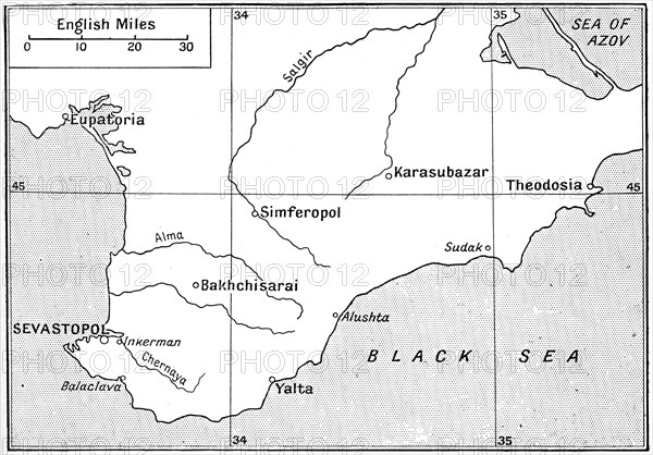
Map of the area where the Crimean War was fought in the 1850s, (c1920). Artist: Walter Hutchinson
Légende
Map of the area where the Crimean War was fought in the 1850s, (c1920). The plan shows the relative positions of the battlefields of Crimea. Illustration from Story of the British Nation, Volume IV, by Walter Hutchinson, (London, c1920s).
The Print Collector collection
Date
30 nov. 1999
Crédit
Photo12/Heritage Images/The Print Collector
Notre référence
HRM19C34_438
Model release
Non
Licence
Droits gérés
Format disponible
33,2Mo (3,0Mo) / 34,5cm x 24,1cm / 4080 x 2848 (300dpi)