Sujet
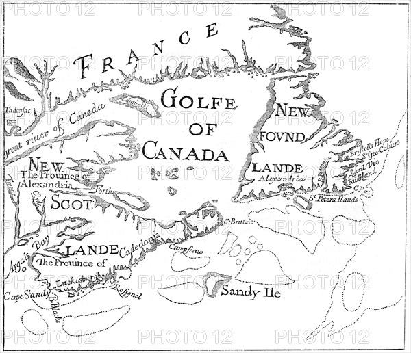
Old map of Acadia, 17th century (c1880). Artist: Unknown
Légende
Old map of Acadia, 17th century (c1880). Acadia (Acadie) was part of the territory claimed by the French in North America from 1604. Corresponding to what is now Nova Scotia, it became a British possession after the Treaty of Utrecht in 1713. A print from Cassell's History of the United States, by Edmund Ollier, Volume I, Cassell Petter and Galpin, London, c1880.
The Print Collector collection
Date
1880
Crédit
Photo12/Heritage Images/The Print Collector
Notre référence
HRM19C49_198
Model release
Non
Licence
Droits gérés
Format disponible
40,0Mo (2,1Mo) / 34,1cm x 29,4cm / 4026 x 3469 (300dpi)