Sujet
'Athelney & Ethandun 878', (1935). Artist: Unknown.
Légende
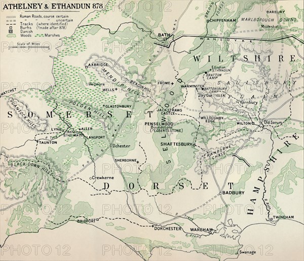
'Athelney & Ethandun 878', (1935). Map of part of the west of England (modern Somerset, Dorset, Wiltshire and Hampshire), showing Athelney, which was once the fortress hiding place of King Alfred the Great. From there he went on to defeat the Danes at the Battle of Edington (or Ethandun) in May 878. The map also shows Roman roads and tracks, Alfred's 'Burhs' (Old English fortifications), Danish forts, and significant sites during the period of Viking invasion. From A History of the Anglo-Saxons, Vol. II, by R. H. Hodgkin. [The Clarendon Press, Oxford, 1935]
The Print Collector collection
Date
1935
Crédit
Photo12/Heritage Images/The Print Collector
Notre référence
HRM19D46_002
Model release
Non
Licence
Droits gérés
Format disponible
56,4Mo (2,7Mo) / 40,6cm x 34,8cm / 4791 x 4112 (300dpi)