Sujet
'Plan of Roman London', (1897). Creator: Unknown.
Légende
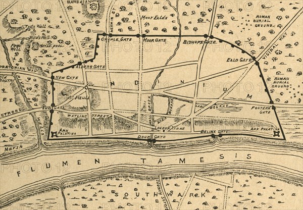
'Plan of Roman London', (1897). Map showing the area of what is now the City of London, as it might have looked during the Roman period. Places and landmarks shown include Watling Street, Barbican, the various gates in the Roman walls, and the River Thames (Flumen Tamesis in Latin). Also marked is St Paul's Cathedral which would not have been built until centuries later. From Old and New London, Volume I, by Walter Thornbury. [Cassell and Company, Limited, London, Paris & Melbourne, 1897]
The Print Collector collection
Date
1897
Crédit
Photo12/Heritage Images/The Print Collector
Notre référence
HRM19D49_481
Model release
Non
Licence
Droits gérés
Format disponible
63,8Mo (4,3Mo) / 48,0cm x 33,3cm / 5668 x 3933 (300dpi)