Sujet
'St. Paul's and Neighbourhood', (1897). Creator: Unknown.
Légende
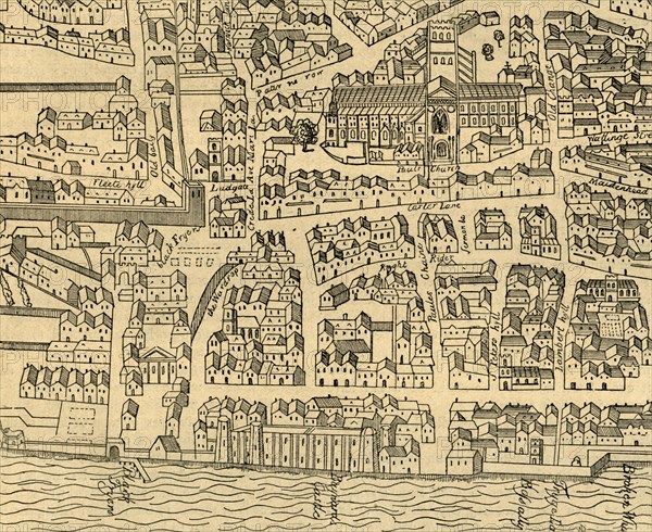
'St. Paul's and Neighbourhood', (1897). Map based on Aggas's plan of 1563, showing St Paul's Cathedral in the City of London. Also marked are the old city walls and Ludgate, with the River Thames at the bottom. From Old and New London, Volume I, by Walter Thornbury. [Cassell and Company, Limited, London, Paris & Melbourne, 1897]
The Print Collector collection
Date
1897
Crédit
Photo12/Heritage Images/The Print Collector
Notre référence
HRM19D50_048
Model release
Non
Licence
Droits gérés
Format disponible
61,9Mo (5,2Mo) / 43,6cm x 35,6cm / 5148 x 4206 (300dpi)