Sujet
'Plan showing the Extent of the Great Fire in Cornhill in 1748', (c1872). Creator: Unknown.
Légende
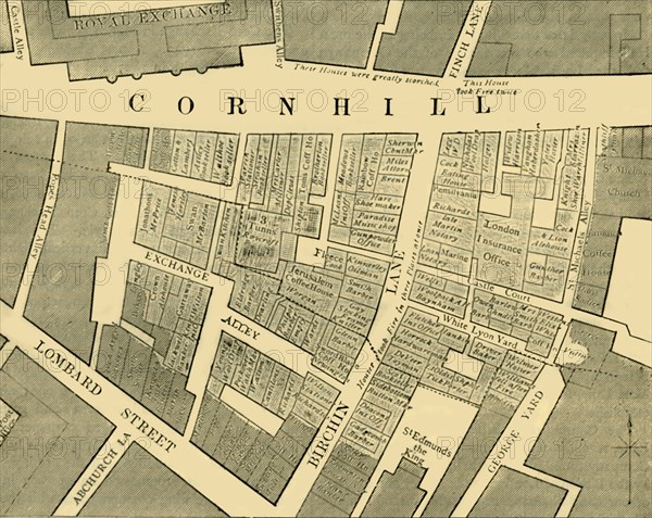
'Plan showing the Extent of the Great Fire in Cornhill in 1748', (c1872). Map of part of the City of London, showing areas affected by the fire on 25 March 1748: 'These Houses were greatly scorched'; 'This house took Fire twice'. The fire is known to have started at Mr Eldridge's, a Perriwig-Maker in Exchange-Alley, Cornhill. Around 80-100 homes were destroyed, and a series of building acts were later passed to make buildings less susceptible to fire. From Old and New London, Vol. II: A Narrative of Its History, Its People, and Its Places, by Walter Thornbury. [Cassell, Petter, Galpin & Co., London, Paris & New York]
The Print Collector collection
Date
1872
Crédit
Photo12/Heritage Images/The Print Collector
Notre référence
HRM19D50_167
Model release
Non
Licence
Droits gérés
Format disponible
59,1Mo (3,5Mo) / 43,1cm x 34,3cm / 5096 x 4056 (300dpi)