Sujet
'Moorfields and its Neighbourhood (From a Map of about 1720)', (c1872). Creator: Unknown.
Légende
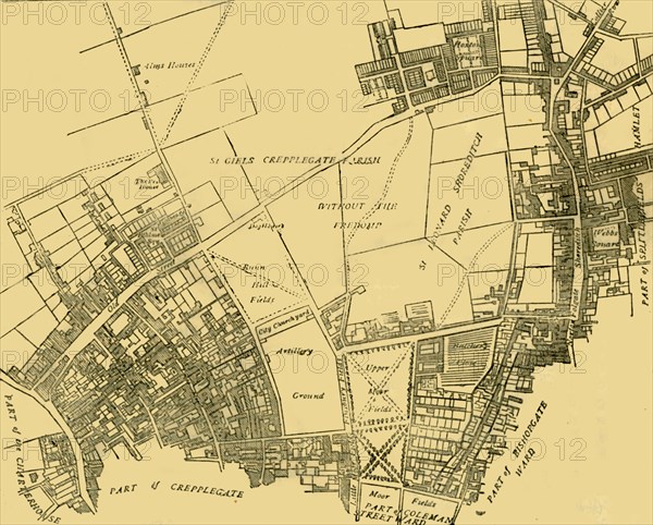
'Moorfields and its Neighbourhood (From a Map of about 1720)', (c1872). Map of part of the City of London, showing the Moorfields, one of the last pieces of open land in the City. Also shown are Bunn Hill Fields, the Artillery Ground, Old Street, Hoxton Square and Shoreditch. From Old and New London, Vol. II: A Narrative of Its History, Its People, and Its Places, by Walter Thornbury. [Cassell, Petter, Galpin & Co., London, Paris & New York]
The Print Collector collection
Date
1872
Crédit
Photo12/Heritage Images/The Print Collector
Notre référence
HRM19D50_173
Model release
Non
Licence
Droits gérés
Format disponible
64,1Mo (2,6Mo) / 44,7cm x 35,9cm / 5278 x 4244 (300dpi)