Sujet
'Whitehall in the Reign of Henry VIII', (1881). Creator: Unknown.
Légende
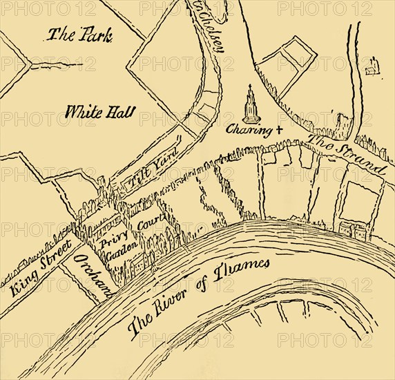
'Whitehall in the Reign of Henry VIII', (1881). Map showing the Palace of Whitehall in the village of Westminster (now part of London), in the 16th century. Henry VIII acquired York Place and had it extended - the name Whitehall or White Hall was first recorded in 1532. Locations and features shown include orchards, the Tilt Yard (for practicing jousting), the Privy Garden, the Eleanor Cross, the Strand and the River Thames. From Old and New London: A Narrative of Its History, Its People, and Its Places. Westminster and the Western Suburbs, by Edward Walford, Vol. III. [Cassell, Petter, Galpin & Co., London, Paris & New York, 1881]
The Print Collector collection
Date
1881
Crédit
Photo12/Heritage Images/The Print Collector
Notre référence
HRM19D50_335
Model release
Non
Licence
Droits gérés
Format disponible
67,6Mo (2,1Mo) / 42,0cm x 40,3cm / 4962 x 4763 (300dpi)