Sujet
'A reduced copy of Fisher's Ground Plan of the Royal Palace of Whitehall, 1680', (1881). Creator: Unknown.
Légende
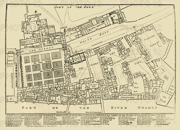
'A reduced copy of Fisher's Ground Plan of the Royal Palace of Whitehall, taken in the Reign of Charles 2d. 1680', (1881). John Fisher's map of the Palace of Whitehall in the village of Westminster (now part of London), in the 17th century. Locations and features shown include orchards, the Great Hall, the Privy Garden, Scotland Yard, and the River Thames. The palace later burned down, and the Houses of Parliament now stand in the area on the left. From Old and New London: A Narrative of Its History, Its People, and Its Places. Westminster and the Western Suburbs, by Edward Walford, Vol. III. [Cassell, Petter, Galpin & Co., London, Paris & New York, 1881]
The Print Collector collection
Date
1881
Crédit
Photo12/Heritage Images/The Print Collector
Notre référence
HRM19D50_336
Model release
Non
Licence
Droits gérés
Format disponible
61,2Mo (3,5Mo) / 46,1cm x 33,3cm / 5442 x 3930 (300dpi)