Sujet
'Plan of a Portion of Westminster Between 1734 and 1748 - Before the Erection of Great George Street Creator: Unknown.
Légende
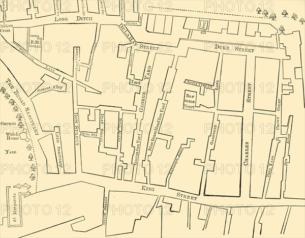
'Plan of a Portion of Westminster Between 1734 and 1748 - Before the Erection of Great George Street', (1881). Map of the area near the Houses of Parliament in London, showing Broad Sanctuary, St Margaret's Church, Bow Street, Thieving Lane, King Street, Charles Street, Duke Street and Long Ditch. From Old and New London: A Narrative of Its History, Its People, and Its Places. Westminster and the Western Suburbs, by Edward Walford, Vol. III. [Cassell, Petter, Galpin & Co., London, Paris & New York, 1881]
The Print Collector collection
Date
1881
Crédit
Photo12/Heritage Images/The Print Collector
Notre référence
HRM19D50_390
Model release
Non
Licence
Droits gérés
Format disponible
48,3Mo (1,5Mo) / 39,4cm x 30,8cm / 4648 x 3632 (300dpi)