Sujet
'Plan of a Portion of Westminster Between 1734 and 1748 - Before the Erection of Parliament Street', Creator: Unknown.
Légende
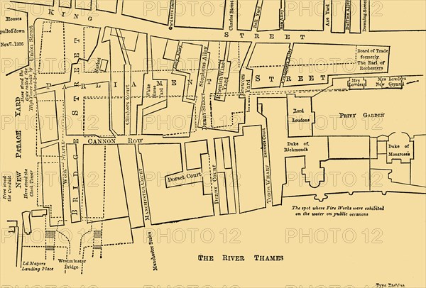
'Plan of a Portion of Westminster Between 1734 and 1748 - Before the Erection of Parliament Street', (1881). Map of the area around the Houses of Parliament in London, showing New Palace Yard, Cannon Row, the Privy Garden, the River Thames and the 'spot where Fire Works were exhibited on the water on public occasions'. From Old and New London: A Narrative of Its History, Its People, and Its Places. Westminster and the Western Suburbs, by Edward Walford, Vol. III. [Cassell, Petter, Galpin & Co., London, Paris & New York, 1881]
The Print Collector collection
Date
1881
Crédit
Photo12/Heritage Images/The Print Collector
Notre référence
HRM19D50_391
Model release
Non
Licence
Droits gérés
Format disponible
41,9Mo (1,6Mo) / 39,4cm x 26,7cm / 4652 x 3148 (300dpi)