Sujet
'Map of Southwark, 1720', (c1878). Creator: Unknown.
Légende
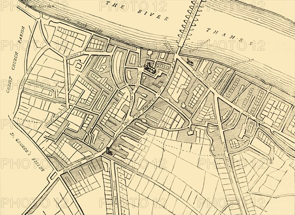
'Map of Southwark, 1720', (c1878). Map showing the village of Southwark on the south bank of the River Thames, in what is now part of greater London. Places shown include the Bank Side, London Bridge, Southwark Cathedral, St George's Fields and Bermondsey Street. From Old and New London: A Narrative of Its History, Its People, And Its Places. The Southern Suburbs, Volume VI, by Edward Walford. [Cassell, Petter, Galpin & Co., London, Paris & New York, c1878]
The Print Collector collection
Date
1878
Crédit
Photo12/Heritage Images/The Print Collector
Notre référence
HRM19D50_408
Model release
Non
Licence
Droits gérés
Format disponible
65,5Mo (3,5Mo) / 47,4cm x 34,6cm / 5604 x 4086 (300dpi)