Sujet
'Hammersmith in 1746', (c1878). Creator: Unknown.
Légende
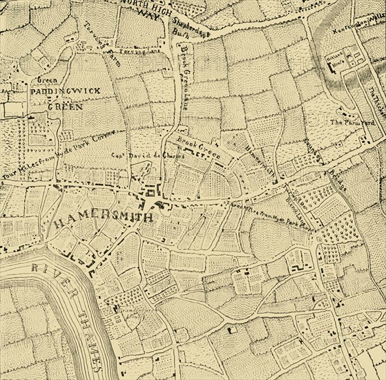
'Hammersmith in 1746', (c1878). Map of an area of what is now west London, showing houses and farms, the River Thames, the mineral springs at Kensington Wells, Shepherd's Bush, and distances from Hyde Park Corner. Hammersmith originally meant '(place with) a hammer smithy or forge'. From Old and New London: A Narrative of Its History, Its People, And Its Places. The Southern Suburbs, Volume VI, by Edward Walford. [Cassell, Petter, Galpin & Co., London, Paris & New York, c1878]
The Print Collector collection
Date
1878
Crédit
Photo12/Heritage Images/The Print Collector
Notre référence
HRM19D51_056
Model release
Non
Licence
Droits gérés
Format disponible
55,6Mo (4,7Mo) / 37,6cm x 37,0cm / 4446 x 4374 (300dpi)