Sujet
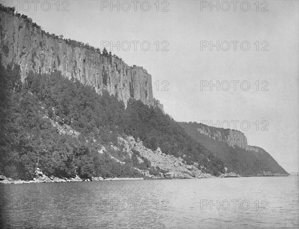
Northern End of Palisades, Hudson River', c1897.
Légende
'Northern End of Palisades, Hudson River', c1897. The Palisades, are a line of steep basalt cliffs along the west side of the lower Hudson River, they appear on the first European map of the New World, made by Gerardus Mercator in 1541. From "A Tour Through the New World America", by Prof. Geo. R. Cromwell. [C. N. Greig & Co., London, c1897]
Date
1897
Crédit
Photo12/Heritage Images/The Print Collector
Notre référence
HRM19F13_094
Model release
Non
Licence
Droits gérés
Format disponible
78,9Mo (3,2Mo) / 50,7cm x 39,0cm / 5990 x 4606 (300dpi)